Zoom time
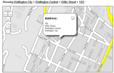
A while ago I did a round up of local mapping resources on the internet, but now there's a new one to add to the list. There was an article in yesterday's Dominion Post about a new mapping service, ZoomIn, from Wellington startup Projectx. At first glance there's nothing special about the map itself:
 It's nice and clean, but lacks some of the detail found on the Wises and Where Are We? maps. However, there are some very nice features, such as the fast and intuitive Google-style panning, auto-completion of street names as you type, and the bread-crumb trail that lets you quickly zoom out to suburb or city level. Unlike either Wises or Where Are We?, it also lets you search by street number and link to it with a simple URL:
http://www.zoomin.co.nz/map/wellington+city/wellington+central/willis+street/192
So far, it's a nice addition to local mapping resources, but they're only getting started. But they're aiming at something more ambitious. Projectx's Ben Nolan says:
"We want to have flavour. We don't want to be a generic, homogenised bloody list of where all the boutiques or Starbucks are in town," he says.That's the sort of thing that people in the US have been able to do with the Google Maps API for a while, and it's spawned all sorts of fascinating commercial and community mapping applications. I've looked before at opportunities for integrating blogging with mapping, but in New Zealand we've always been limited by the lack of online mapping services. Perhaps all this will change when ZoomIn's API becomes available next month.
"We want it to be a lot more 'two-way', so instead of just indexing things and plotting them on the map, we want people to add stuff - like their views of what cafes they like and what beaches are good, so people can use it to share information. They could perhaps take a photo of some street art and add it to the map."


0 Comments:
Post a Comment
<< Home